

The Bus Map of South Coimbatore
About the Project
This map was designed as a part of my Design for Social Change course, where my initial brief was to research on the public transportation sector of Coimbatore, India and identify it's major problems. After 3 weeks of intense research, I discovered that the issue with dire need for reform was the Inaccessibility of the Information about the existing bus numbers and routes. To view full research, visit here.
Redefined Brief
“To design the means for a public transport user to ensure easy access of information about the different bus routes.”
The target audience comprised of a huge chunk of people that were technologically inexperienced. Hence designing a traditional map that will be placed in every bus stop was deemed a fit solution to cater to all their needs. The map provides ready information about the different bus routes and numbers, the different bus stops across the area and the in-between stops of each individual bus.
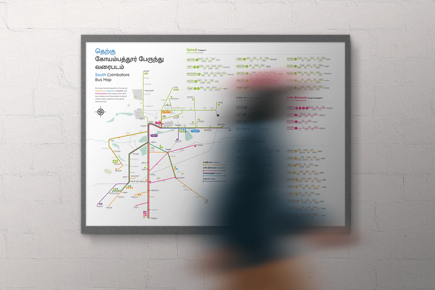
Coimbatore alone has 300+ bus stops and 320+ bus routes. So I split the district into north, west, east, south and central Coimbatore to design individual maps for each to ensure a digestible amount of information per map. The map for south Coimbatore was then designed in 1 week.

Features of the Map
The map is accurate to the geography of the area, including proportional distances between the bus stops, illustrated icons of known buildings and localities, topologically precise water bodies and indication of major and minor bus stops.

Color Coding System
After studying the bus routes, I realized that there are 4 major connectivity points across the whole of Coimbatore, namely Gandhipuram, the Railway Station, Ukkadam and Singanallur. Each bus route is bound to pass through at least one of these points. So I used these points to categorize the buses into different colors.
Each major point was assigned a color, and buses that start and stop at that particular point was assigned the stop color. Direct buses, or buses that start and stop at bus stops that are not the major points were assigned a separate color.

Legend
Every bus route is detailed with the start and end bus stop, along with the intermediate stops beside the map.

Language and Typography
The entire map, including the legend is in both Tamil and English. With a predominantly Tamil speaking audience, preference was given to Tamil over English in terms of hierarchy
The typefaces were chosen with careful consideration to have enough harmony between both the languages, while maintaining a friendly, approachable feel.

Markers and Icons
Every bus number is marked beside the route on the map, and each marker pointing at the stop indicates the colors of
the routes that stop there and icons were designed to indicate major buildings and locations.


